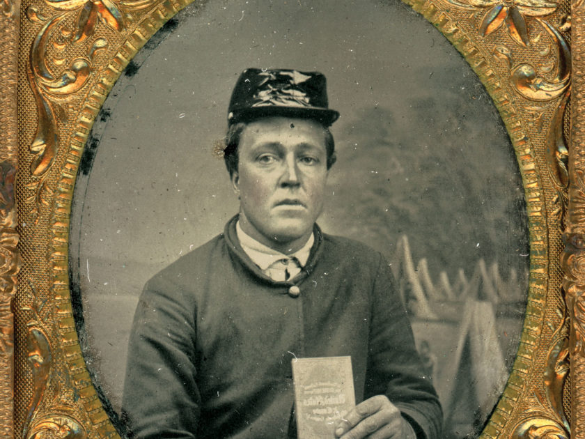
The thin volume held by this Union enlisted man may have helped him pinpoint the movements of his regiment during its Southern tour. The pocket-sized book, G. Woolworth Colton’s New Guide Map of the United States & Canada With Railroads, Counties & c., contained color-tinted maps that folded out to about 30-by-35 inches. It is one of a series of popular guides published by geographer George Woolworth Colton (1827-1901). His father, Joseph Hutchins Colton (1800-1893) started the business in the early 1830s. The Colton guide maps were recognized for excellence and quality.
The unnamed soldier, dressed in a four-button sack coat and cap with rainproof cover, sits in front of a backdrop painted with a camp scene. He wants us to see the book cover—perhaps a suggestion of the journey to come. Though his fate is currently unknown, a note inside the badly damaged case indicates he made it to Hilton Head Island, S.C. Union forces captured it in late 1861 and established a major base of operations against Charleston and Savannah, Ga. The island also became a refuge for former slaves.
The fate of this soldier and the usefulness of Colton’s Guide to him are not known.
SPREAD THE WORD: We encourage you to share this story on social media and elsewhere to educate and raise awareness. If you wish to use any image on this page for another purpose, please request permission.
LEARN MORE about Military Images, America’s only magazine dedicated to showcasing, interpreting and preserving Civil War portrait photography.
VISIT OUR STORE to subscribe, renew a subscription, and more.

